More tropical cyclone activity east of the Dateline in the Pacific Ocean, currently a Hurricane and a Tropical Storm are active...
Hurricane JULIO (75mph), Tropical Storm KARINA (40mph) and Invest 90E are the main players in the East/Central Pacific hurricane basins...
Image below adapted from NOAA
Hurricane JULIO has regained its strength, now with estimated sustained surface winds of 75mph (Category 1), while over open waters of the Central Pacific Ocean, and under warning responsibility of the Central Pacific Hurricane Center (CPHC - RSMC Honolulu). JULIO is one of the few storms on record to have maintained hurricane intensity north of 30N in the Central Pacific in recorded history. In fact, Brian McNoldy found that only 6 storms have previously achieved this milestone, making JULIO the 7th in that elite. The storm should move slowly northeastward until dissipation occurs, far from land.
Hurricane Julio 75mph (Source: NASA)
Hurricane JULIO has been moving over higher-than-normal sea surface temperature (SST) anomalies. In fact latest NOAA analysis shows anomalies of no less than 1.5 deg Celsius where the hurricane is located. This has certainly been a favorable factor in JULIO's remarkable achievement.
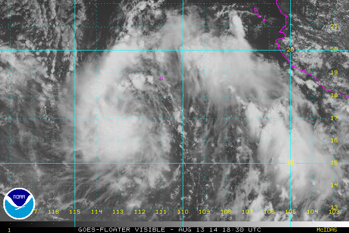
Newly-born Tropical Storm KARINA does not represent an immediate threat to land. It is expected to move away from Mexico and into open waters of the Pacific Ocean. It may also end up crossing the 140W longitude to enter the CPHC responsibility area, as also did GENEVIEVE, ISELLE and JULIO. This storm may show some interesting interactions if another system later forms to its east, potentially forcing some Fujiwara interactions over open waters (per 12Z August 13 GFS run). This is a long shot, but worth watching if it happens. For now, it does not appears that KARINA will directly threat the Hawaiian Islands.
KARINA should become a hurricane (per NHC forecast). A limiting factor in KARINA's potential intensity will be the cold wake left by hurricane JULIO in the area (see image above). These cooler SSTs may also be related to a more stable marine environment, unfavorable for sustained deep convection. Otherwise, vertical shear should remain relatively low, this favoring upright vertical structure and intensification.
Tropical Storm KARINA 40mph (Source: NOAA)
12Z Guidance for Tropical Storm KARINA
Another system named Invest 90E may track near to the south of Hawaii and develop into a tropical storm or Hurricane. CPHC grants it a 30% chance of development within the next 48 hours. 12Z guidance takes it in the general direction of the islands, while global models like the GFS and CMC take the system to their south. Interestingly, ECMWF makes this an intense storm and moves it close to the east of the Big Island while later recurving without direct hit. The FIM 15km model takes it just south in an almost direct hit. Lots of uncertainty this early in the game. For now, it can be said that: This system could be of interest for the Hawaiian Islands in about 5 days.
The Atlantic Basin remains quiet... GFS model shows a potential Cape Verde storm in a week. Lots of time ahead to watch that one. For now, lets keep our eyes where the action is, the Pacific Ocean.
Greensboro, NC (8/13/2014) 3:18pm


No comments:
Post a Comment